Byway Attractions
High Park Road - 01
High Park Road
38.585707, -105.417997
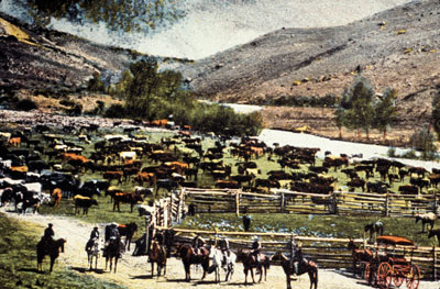
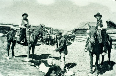
High Park Road and Colorado Highway 9 were originally trails that connected the ranches and farms of the mountain parklands west of Cripple Creek to Cañon City. The Currant Creek Trail followed the route of present day Colorado Highway 9. Well-traveled by American Indians moving between the Arkansas River and South Park, this trail became an important route for the mountain men, explorers and eventually, people and freight headed for the mining camps of Leadville and South Park.
To settlers, the grassy meadows of High Park seemed ideal for raising cattle and horses; however, ranching and farming proved challenging occupations here. Settlers endured summer drought, harsh winters, unpredictable markets, rustlers and isolation. With the gold boom in Cripple Creek, ranchers and farmers enjoyed a convenient market for their products.
In 1897, the Fremont County Cattlegrowers Protective Association formed allowing ranchers to work together on common problems and to share information on important issues. Today a few of the original ranches remain, a testimony to the tenacity of early settlers.
A Look at High Park Road
High Park Road - 02
Deer Haven Ranch
38.623382, -105.380024
The five thousand acre Deer Haven Ranch includes lands that were once a part of the Switzer Ranch. Homesteaded in the early 1870s, this was one of the first cattle ranches in Fremont County. It remained a private ranch until 1992 when the Richard King Mellon Foundation and the Conservation Fund donated Deer Haven Ranch to the Bureau of Land Management to protect and enhance its rich wildlife habitat.
Historic structures on the ranch include the one-room Wilson Creek Schoolhouse and several buildings and foundations associated with ranching operations.
A Look at Deer Haven Ranch
High Park Road - 03
Bare Hills City
38.64845, -105.3341675
In 1896, prospectors founded the Bare Hills Mining District in this area. Promoters selling lots declared Bare Hills City "the future great town" of the area because it was "surrounded by veins... assaying high in gold" with "...the whole formation being the same as the gold belt of Cripple Creek." Soon, people flooded into the area, including some reputable investors.
The 1898 Colorado State Mining Directory lists fourteen mining companies in the Bare Hills District. The initial optimism died as the promoters' claims proved to be more dream than reality. Within a few years, only a few families remained. The area is part of a cattle ranch and private property.
High Park Road - 04
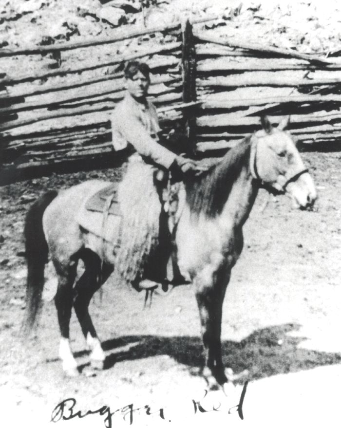
Booger Red Hill
38.713815, -105.260780
A young cowboy arrived in the Fourmile area of Teller County in 1915. Booger Red he was called because of his thick red hair and his ornery nature towards others. He worked many of the ranches in the area and met a ranchers daughter named Ruth Hall. In the fall of 1918 Red contracted Spanish Influenza and died around the age of 22. Ruth suggested he be buried near Texas Hill.
A Look at Booger Red Hill
High Park Road - 05
Four Mile Hall
38.767294, -105.286306
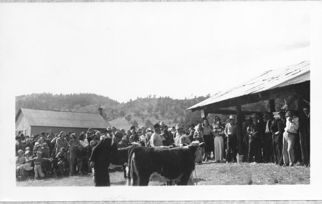
This building has been a focal point for local agricultural programs and social events since its construction in 1911 by members of the surrounding community. It was built of lumber milled at a saw mill just down the road, and was first called the High Park Dance Hall, as it was built to host bi-monthly dances.
In 1926, the Four Mile Farmers Club organized the first Four Mile Fair here. Known to many in the region as "The Best Little Fair in Colorado," the Four Mile Fair consistently drew large crowds to enjoy the many exhibits until it ended during World War II. Today, this building hosts dances, meetings and a variety of other events for area residents.
A Look at Four Mile Hall
High Park Road - 06
Conservation Efforts of Area
38.821831, -105.259650
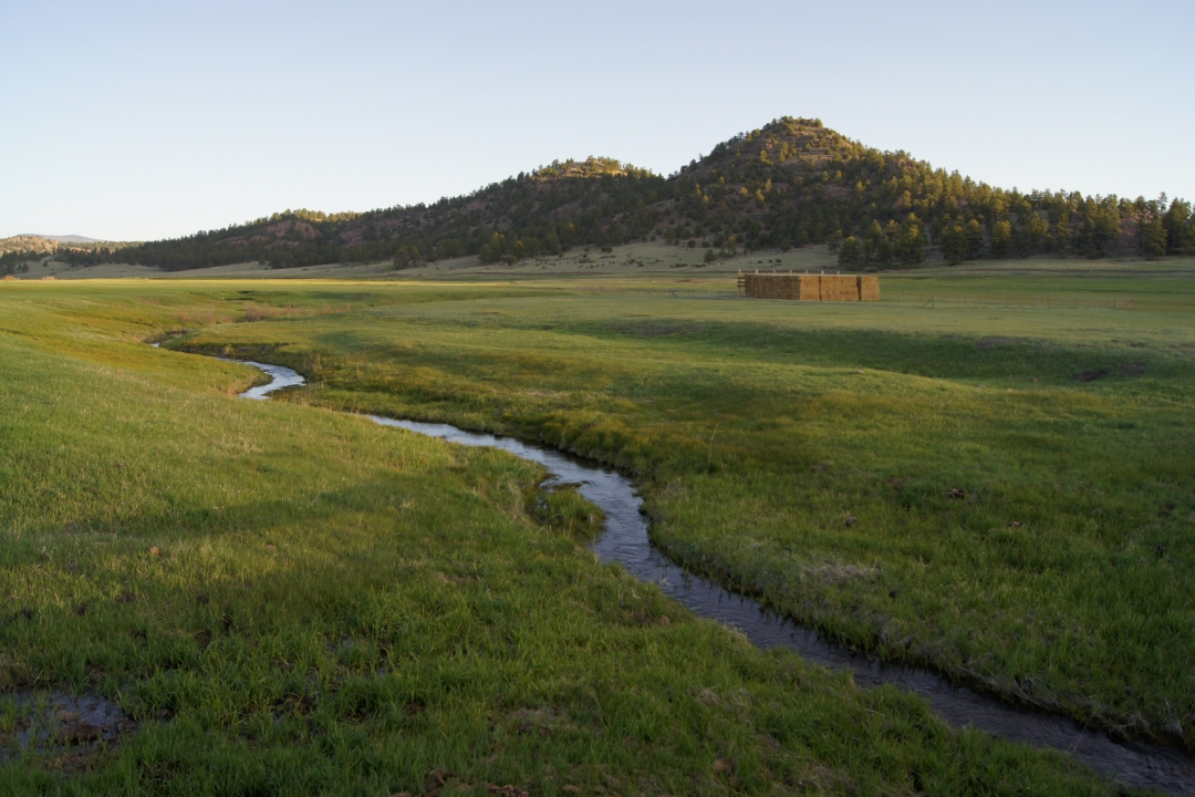
Palmer Land Trust has conserved over 3500 acres along the Gold Belt Scenic Byway, one of the country's premier scenic byways. It contains an impressive topography and a variety of ecosystem types that span areas ranging from 6,900 feet to 10,000 feet in elevation, with views of the back side of Pikes Peak, "America's Mountain," world-class rock climbing, and the valley floor of Fourmile Creek.
A variety of habitat types, including riparian shrubland and irrigated pasture habitat as well as ponderosa, pinion pine woodland, and montane grasslands, provide habitat to bighorn sheep, wild turkey, black bear, mule deer, and mountain lion. Historically, the area has been used for ranching and some still remain productive today for rotational grazing and irrigated hay meadows.
Recreationists also flock to the area to take advantage of the scenic open space for hiking, biking, and fishing. The conservation efforts along the byway address all these attractions: Colorado's farming and ranching heritage, open spaces and scenic vistas, public access to recreational opportunities, and wildlife habitat.
A Look at Conservation Efforts of Area
Need Help With Ideas For Your Itinerary Of Your Tour?
We Can Help! Contact Gold Belt Tour Scenic and Historic Byway