Byway Attractions
Phantom Canyon - 01
Florence
38.386931, -105.11506
In 1880, James A. McCandless purchased a 160-acre homestead just south of the Arkansas River. Soon after, the Denver and Rio Grande Railroad laid tracks to the Arkansas Valley�s coal mines. The railroad stop became known as Frazierville or La Bran. The McCandless homestead adjoined the railroad�s branch line to the coal mines. McCandless staked his fortune on the railroad and platted part of his farm as a town site. He named the town �Florence� in honor of his young daughter.
The discovery of the Florence Oil Field in 1881 brought increased prosperity to the area. Over the next several decades, Florence became an important center for oil production and refining. Residential areas and the downtown business district expanded to provide the goods and services required by the thousands of people employed by Standard Oil.
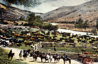
In 1890, the discovery of gold in Cripple Creek proved a boon to Florence, too. Once again, James A. McCandless led the push for a road from Florence to the gold mines. The Arkansas River possessed plentiful land, water, and fuel � all scarce in the mining district. McCandless joined forces with several other prominent citizens and built the Florence Free Road in 1892, following the canyon of Eightmile Creek. The road was a roaring success � carrying supplies to the burgeoning mining district.
Just over one year later, Denver tycoon David H. Moffat financed the transformation of the Florence Free Road to the Florence and Cripple Creek Railroad. Construction began in December of 1893. On July 1, 1894, hundreds of people celebrated the arrival of the first train in Cripple Creek � a Florence and Cripple Creek Railroad passenger train.
In 1900, Florence�s prosperity reflected the immense wealth flowing from the Cripple Creek Mining District. Now, Florence�s population numbered seven thousand. Each day, several trains carried coal, lumber bricks, merchandise, machinery, and food into the mining district and returned heavy with gold ore. Florence�s eight mills processed more than 1,300 tons of gold ore daily.
At present the myriad of antique stores and art galleries in Florence are honoring our historical past and recycling for future generations. �Come and enjoy all the fine shops, restaurants, historical buildings and many family activities in friendly Florence.
A Look at Florence
Phantom Canyon - 02
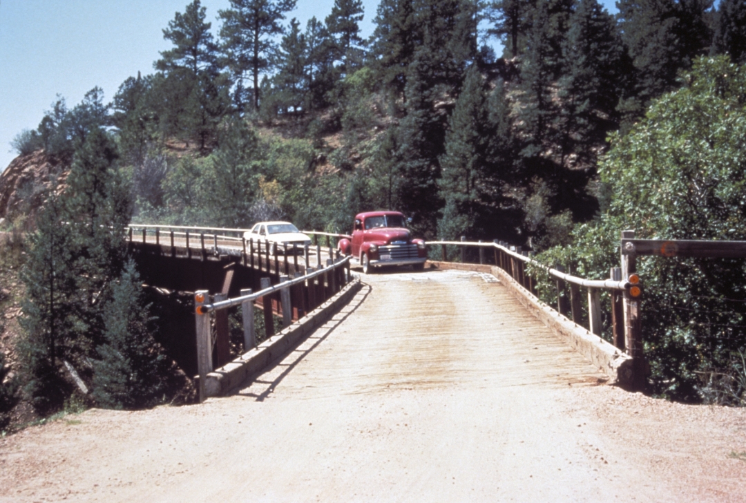
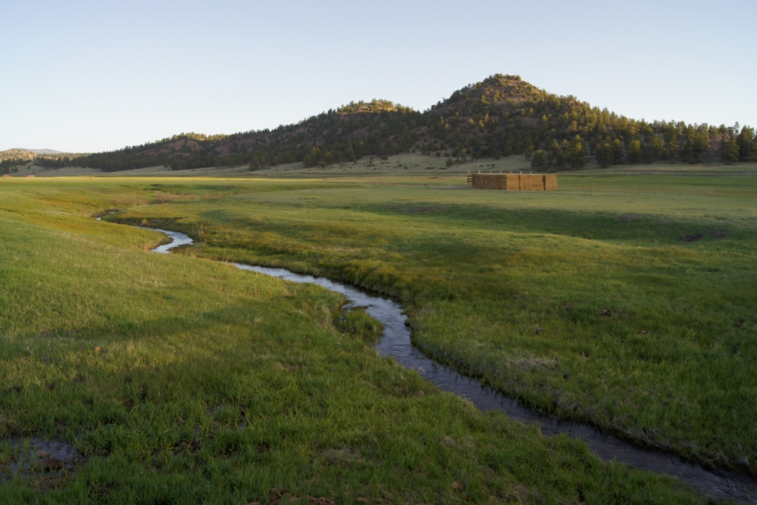
Phantom Canyon
38.437535, -105.113011
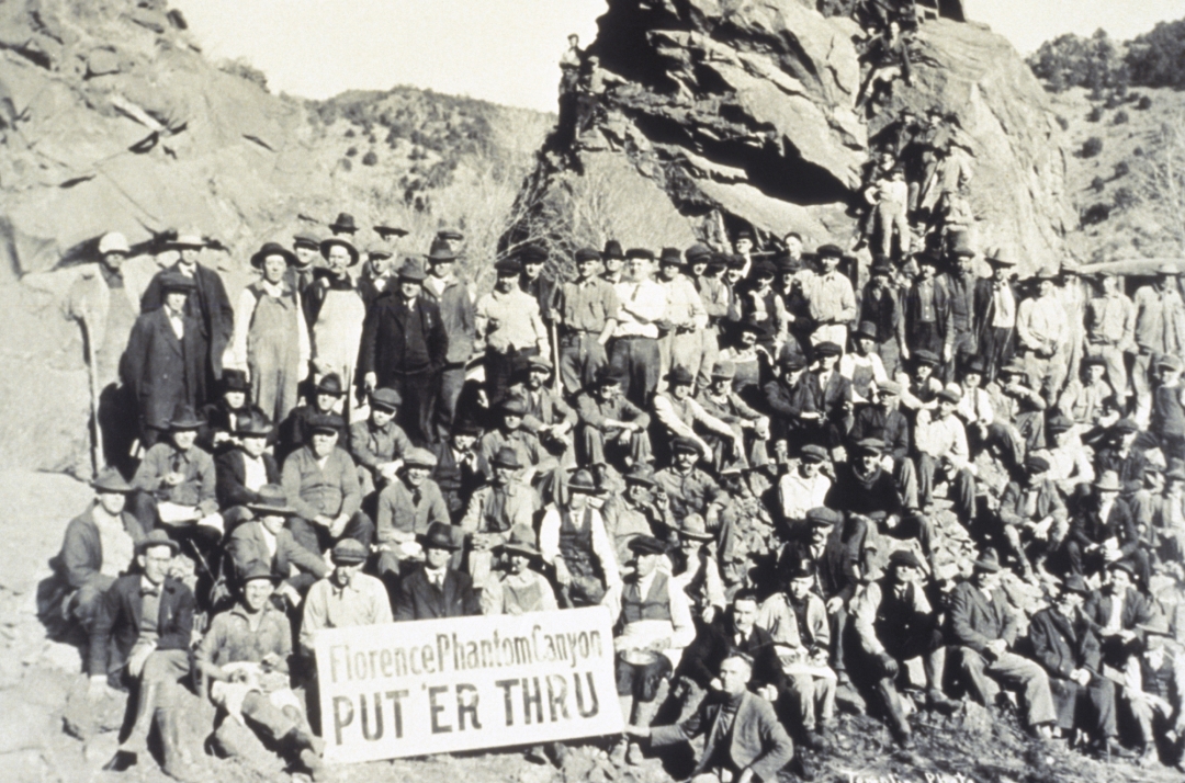
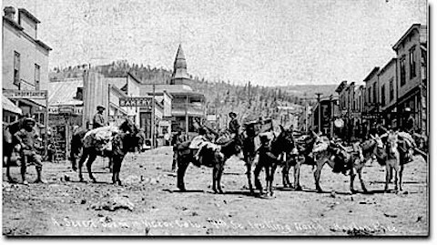
The Cripple Creek Gold Mining District, destined to be the world's richest gold camp, had a slow start. Early in the gold boom, rough trails and wagon roads were the only way to the mining district. Horse-drawn wagons carried gold or 20 miles north of Cripple Creek to the Colorado Midland Railroad for shipment to smelters in Pueblo and Denver. Wagons were so costly and slow that only the richest ore left the district. Cripple Creek needed modern transportation.
In 1894, the race was on to bring rail service to the mining district. From the south, the tracks of the Florence and Cripple Creek Railroad, the F&CC, climbed through rugged Phantom Canyon. The F&CC was a narrow gauge railroad; the distance between the rails was three feet. This made construction through the rugged terrain easier and faster.
On May 27, 1894, the first passenger train of the Florence and Cripple Creek Railroad climbed up Phantom Canyon to the town of Victor. The F&CC won the race to the mining district connecting Cripple Creek with the modern world. For 18 months, the F&CC enjoyed a virtual monopoly on rail transportation in and around the mining district.
A Look at Phantom Canyon
Phantom Canyon - 03
Cramer
38.435875, -105.108049
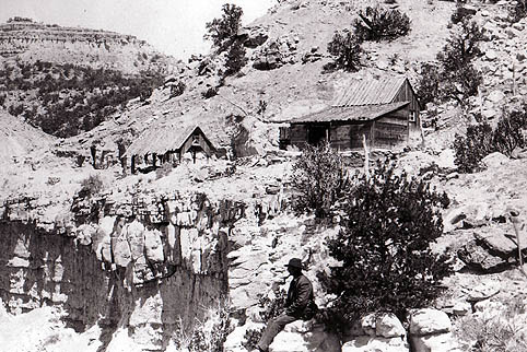
A station at the lower end of railroad route. The Cramer station is where helper engines that had disengaged at the top of the climb near Victor, traveled back down the grade to hook up with and haul up another train.
Phantom Canyon - 04
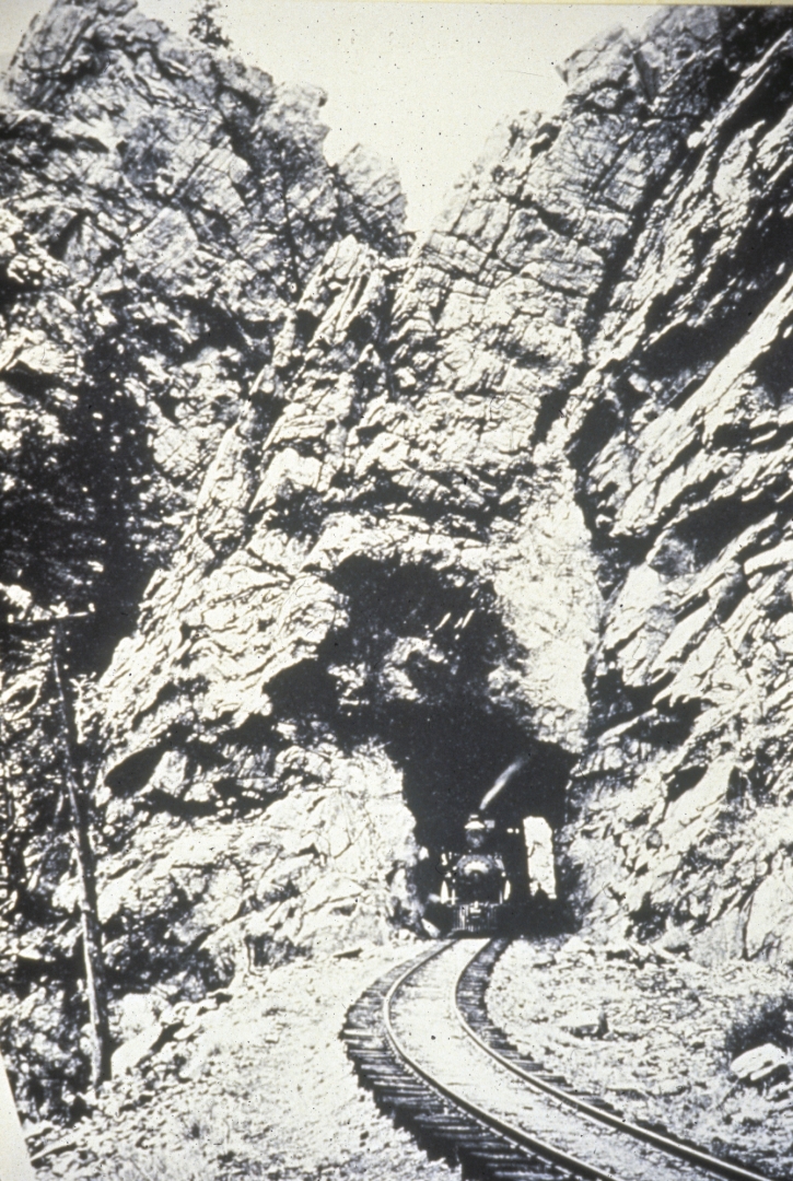
Tunnel 1
38.519568, -105.124265
Built in 1895 following a devastating flood, F&CC they decided to raise the line out of the flood danger. In doing so they had to blast, chisel and cut there way through the granite, no timbers support the structure., building 1 of the 2 tunnels still used today.
Phantom Canyon - 05
McCourt Station
38.537464, -105.119517
In 1894, the Western Union Telegraph Company agreed to provide a telegraph line paralleling the railroad line. This station was the site of a small telegraph office and passing track. Messages sent by telegraph coordinated train movements along busy rails.
Phantom Canyon - 06
Adelaide Tunnel - 2nd Tunnel
38.54822, -105.104226
This 2nd tunnel (Adelaide Tunnel) was created after the line was raised out of the creek bed just the same as the 1st tunnel was. In order to raise out of flooding danger tunnels had to be constructed in a few places.
Phantom Canyon - 07
Adelaide
38.559817, -105.090511
Adelaide is a small town along the F&CC line complete with a post office and train station that also served as a hotel of sorts if the train had to stay overnight. The trains also took on water at Adelaide station to help support the large steam engines used to power the train as well as help put out any fires that might occur along the way do to the cinders produced by the train.
On the night of July 30, 1895, a flashflood roared down the canyon destroying several miles of track and heavily damaging bridges. At Adelaide, three people died when the force of the water demolished the small boarding house near the station. The raging waters carried one body twelve miles downstream! In less than a year, six miles of track between McCourt and Adelaide were relocated and the two tunnels were bored to place the track and all buildings out of the reach of floodwaters.
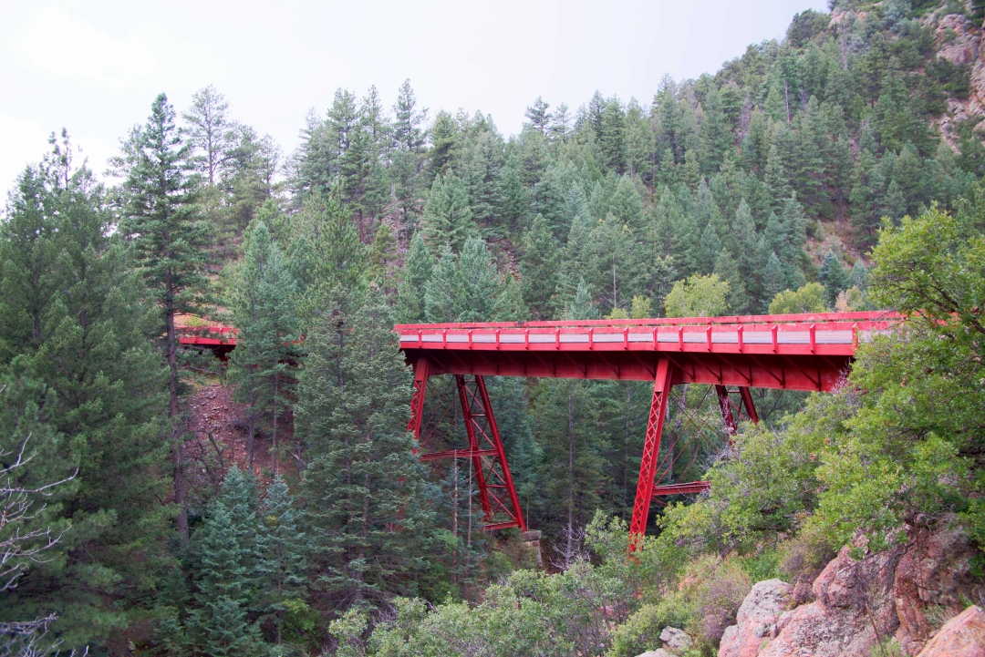
Phantom Canyon - 08
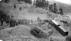
Steel Bridge (Adelaide)
38.571179, -105.086688
Built in 1897, these three steel spans replaced a wooden railroad trestle that burned in 1896, it is
the only surviving original bridge on the F&CC line. When the railroad was dismantled they decided the state would have to put in a detour around where this bridge was because they were going to tear it down and recycle the steel.
The Florence Refiner on May 14, 1901 recounts a train wreck here: On Saturday morning, May 11, 1901, freight train No. 69 ran away at the Steel Bridge. Nine loaded ore cars and the engine left the track and piled upon one another in a tangle of ore, twisted iron and timber. The engineer died and the head brakeman was seriously injured.
A Look at Steel Bridge (Adelaide)

Phantom Canyon - 09
Wilbur
38.632667, -105.111919
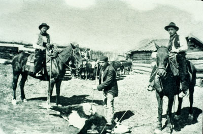
The largest community settlement along the route with 15 families and the site of the only school house too. The F&CC would sometimes stop and throw off coal to be used for heating the school in the winter.
Phantom Canyon - 10
Victor
38.7097, -105.1408
Founded in 1893 by Brothers, Frank and Harry Woods, Victor lies at the foot of Battle Mountain, site of many of the District�s richest mines. The Independence Mine here made Windfield Scott Stratton the District�s first multi-millionare. In 1896, the Woods brothers were excatvating the foundation for a first-class hotel in the heart of Victor�s business district. The discovered a rich gold vein, scrapped the plans for the hotel and built the Gold Coin Mine.
Home to mines, miners, and a bustling business district, Victor has always taken pride in its reputation as �The City of Mines�. Victor�s gold mining history is still being written, as it is headquarters for the Cripple Creek and Victor Gold Mining Company � a modern gold mine located just outside of town.
The Victor Downtown Historic District reflects the wealth and prosperity that resulted from the Gold Mining operations. The Historic Victor Hotel located at Fourth Street and Victor Ave, was constructed for Frank and Harry Woods, who operated a bank in a portion of the first floor retail space. Just a few blocks away, the brick foundation and grand hoist of the Gold Coin Mine are visible.
At the edge of town lies Battle Mountain, where a short walk takes you to Stratton�s Independence Mine and Mill. You can also enjoy a close-up view of the Portland, Ajax, Strong and Gold Coin Mines and a bird�s eye view of historic Victor.
Victor, Colorado�s modern day treasures are the result of its rich gold rush history. Victor, about 5 miles from Cripple Creek, was platted in 1893. The streets of Victor were paved with gold during the hey day of the 1890�s gold rush. Today the streets are line with a wealth of history as century-plus-old buildings stands as a legacy to the hustle and bustle of previous times.
Phantom Canyon - 11
Victor Lowell Thomas Museum
38.70997, -105.139853
The Lowell Thomas Museum houses artifacts and displays that depict the town�s golden history- as well as a room full of memorabilia from Lowell Thomas, America�s celebrated radio and television journalist.
Phantom Canyon - 12
Victor City Hall
38.71063, -105.142424
The Victor City Hall, built in 1899 after the fire that destroyed city�s downtown, has been refurbished to its original condition. City Hall is home to the government offices. Also in City Hall is the old town jail. Inscribed on one cell wall is Jack Dempsey�s signature. The famous boxer trained in Victor and worked in the local mines mucking ore for a living. Historically the fire fighting equipment was housed in a bay behind the large wooden double garage doors on the ground floor. The traditional council and court chambers are located upstairs.
Phantom Canyon - 13
Vindicator Mine Trail Head
38.725172, -105.123406
This trail offers aces to Vindicator Valley, the historic location of the town of Independence and several of the district�s largest mines. Interpretive signs with historic photos of 1890�s gold mines, information about railroads, gold rush towns, as well as current-day mining and reclamation are located along trail.
Shelf Road - 01
Shelf Road
38.614739, -105.224925
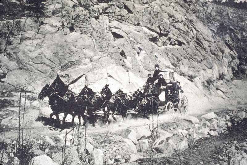
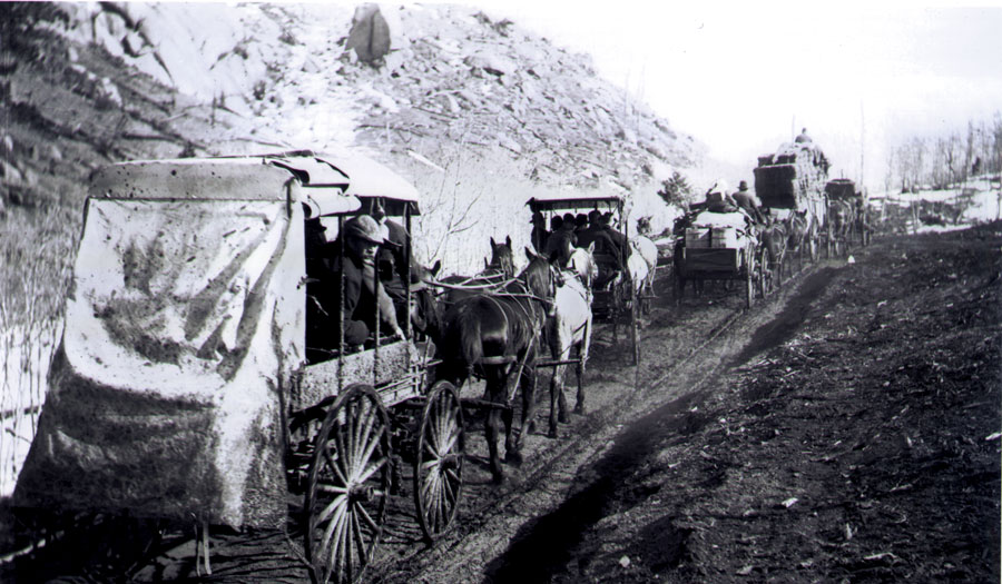
Shelf Road transformed an untraveled wilderness into a major route for the stagecoaches and freight wagons traveling between the Arkansas Valley and the Cripple Creek Gold Mining District. The rugged route’s name is ‘THE SHELF’, a five-mile stretch of road that hugs the sheer rock walls of above Fourmile Creek.
Originally called the Cañon City and Cripple Creek Toll Road, Cañon City’s business leaders financed the road. The toll collectors lived in small cabins nestled at either end of the Shelf and collected tolls every time a horse, wagon or stagecoach passed.
The toll varied from 30 cents to $1.75 for single riders, wagons, and stagecoaches. Ranchers driving cattle along the road paid for each head. Eventually, competition from railroads put the toll road out of business. Fremont County purchased the road and opened it as a free road. This road has made for a memorable trip since its construction in 1892 so be prepared for a driving adventure.
A Look at Shelf Road
Shelf Road - 02
Oil Well Marker
38.513253, -105.208504
In 1880, a grain miller named Gabriel Bowen filed a claim to an oil spring on the east bank of Four Mile Creek. Within two years, A.M. Cassidy and his partners had acquired the oil spring and drilled a well- the first oil well in Colorado. Wagons hauled the oil to Denver, Pueblo and Santa Fe to be used as lamp oil and machine lubricant. Eventually, this small oil well led to the discovery of the Florence Oil Field in 1881.
Shelf Road - 03
Garden Park
38.573333, -105.225278
Garden Park, a classic example of a fertile down-thrown valley, lies at the base of, and is surrounded by, uplifed rocks of the Rocky Mountain Front Range. Four Mile Creek runs through Garden Park and provides a water source for irrigated agriculture. Irrigation capability made Garden Park and attractive location for settlers who took advantage of free land offered by the Homestead Act of the post-Civil War period.
By 1900, over 60 families made a living in agriculture by providing produce for export to the mines in Cripple Creek and Victor. Investors from Canon City built a toll road that today is part of the Gold Belt Tour and is known as the Shelf Road. The Shelf Road, along with the Florence and Cripple Creek Railway (now the Phantom Canyon Road), were two of the three major supply routes to the mining district.
For a period of 25 to 30 years following the discovery of gold in Cripple Creek, Garden Park operated as a prosperous agricultural community, but the downturn of the fines following WWI and the end of the Gold Standard resulted in a major loss of market for Garden Park produce. As a result, homesteaders sold off land and water rights and left the valley.
A few individuals consolidated the 60+ homesteads into a handful of moderate to large ranches that persisted until recently. However, starting in the late 1990s and early 2000s, these ranches, in turn, began to be sold off and broken up in the form of subdivisions with home sites of approximately 35 acres. Once again, Garden Park has approximately 60 families, but most of them are not practicing agriculturalists. Many are retirees, and with 35 acre homes sites, the potential population density is 4 to 8 times what it was in 1890, when homesteads were 160 to 320 acres.
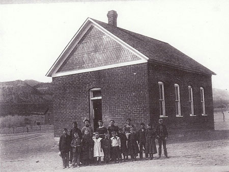
While visiting Garden Park, be sure to stop at the historic Garden Park School (1895), constructed of adobe bricks made from local soil. You may also wish to take a short walk to one of several famous sites where dinosaur fossils have been discovered or scale the cliffs of The Bank climbing area.
A Look at Garden Park
Shelf Road - 03A
Garden Park School
38.565181, -105.230047
The school structure that still stands today was originally completed in 1895 as the 2nd Garden Park School. The first having been lost to a fire in 1891 as it was constructed of wood in the late 1870s. The last classes were taught here in 1963. With only 6 students that last year the school was no longer needed and closed it’s doors after consuladation with Canon City School District. During its time the school housed many public and religious events as a local community center.
Restoration work began on the building in 2010, the west wall you see today, was nearly to collapse, but with the help of Colorado State Historical Funds the wall was disassembled, new foundation installed and then the wall was rebuilt using many of the old bricks. Work planned for 2014 includes new roof and stucco on the exterior walls.
A Look at Garden Park School
Shelf Road - 04
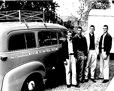
Cleveland Quarry
38.532614, -105.218975
The discovery of the dinosaur site known as the Cleveland-Delfs quarry was made in the summer of 1954, on a field expedition by the Cleveland Museum of Natural History. The rare dinosaur, HAPLOCANTHOSAURUS (simple spined lizard), was found along an eroding bend of Four Mile Creek in a layer of mudstone.
Now in the Cleveland Museum, “Happy” is a giant plant-eating sauropod of the late Jurassic period, 155 to 152 million years ago and represents a new species called HAPLOCANTHOSAURUS delfsi, named after Dr. Edwin Delfs, M.D., leader of the original crew who located this rare dinosaur in Garden Park. (See photo.)
Dr. Delfs returned to Garden Park in 1991 for the dedication of a plaque in recognition of his discovery. (See photo.) This is the largest known and only HAPLOCANTHOSAURUS to be mounted and on permanent display in the United States.
A Look at Cleveland Quarry
Shelf Road - 05
March Quarry Trailhead
38.535033, -105.221747
Marsh-Felch Quarry 1977. Started when O.C. Marsh sent employee Benjamin Franklin Mudge out to Canon City to investigate the claims of such large fossils being discovered and shipped back to Cope by Lucas for further research. Mudge attempted to persuade Lucas to send any specimens back to his boss O.C. March. But after little success Mudge began working with a local farmer named Marshal P. Felch who had also started his own quarry in 1877 only about a mile from the Cope Quarry. Those excavated dinosaur bones were sent back to O.C. Marsh.
A Look at March Quarry Trailhead
Shelf Road - 06
Canterbury Homestead and Toll Gate
38.623406, -105.219600
The Shelf Road was made as a means of travel between Canon City and Cripple Creek. After the discovery of gold to the north, business men from Canon City saw the road as an investment opportunity and began to charge a toll for its use. A stage line was established around 1894 along the road by Charlie Canterbury Sr. and E.C. Higgins.
Canterbury operated the lower toll gates and Higgins drove the stage. The stage line only lasted a few years until the railroad routes were established. But Canterbury decided to homestead there in a canyon near his toll gate.
Shelf Road - 07
Marigold Town Site
38.663178, -105.225125
Marigold was a stage stop between Victor and Cripple creek and was a construction camp for the Carlton Tunnel between 1930 and 1941. It had a post office between 1895 and 1902 and is seasonally occupied with several era structures.
Shelf Road - 19
Carlton Tunnel
38.665154, -105.226300
Completed in 1942 as a drainage tunnel from Vindicator to Marigold. This tunnel further increased the drainage abilities of the deeper mines around Victor. The tunnel was dug so straight it was possible to see the tiny pinpoint of light opening a little over 6 miles away. It allowed mines like the Ajax, Portland 2 and Cresson to reach depths between 2,300 and 3,000 below the surface without flooding. Water from the Carlton Tunnel still flows adjacent to Fourmile Creek.
Shelf Road - 20
Cañon City
38.446800, -105.228305
Settled by the Anson Rudd family in 1860, Cañon City quickly became a regional center for commerce. The Arkansas River and its numerous tributaries provided ample water for agricultural, residential and industrial uses. Farms, ranches and orchards flourished in the fertile soils along the river. Silver and gold discoveries in the surrounding mountains provided a ready market for Cañon City farmers and merchants.
Wagon roads and railroads proved critical to Cañon City’s success. Wagon and stagecoach roads stretched south to the silver mines near Westcliffe and Silvercliffe and northwest to the silver and gold mines of Alma, Fairplay and Leadville. In the late 1870s, the Atchison, Topeka and Santa Fe Railroad (AT&SF) and the Denver and Rio Grande Railroad (D&RG) arrived in town.
With the gold discoveries in Cripple Creek, a group of Cañon City businessmen quickly financed and built the Toll Road (Shelf Road) in 1892. When the Railroad was built up Phantom Canyon in 1894, which proved more efficient connection than the wagon road. Cañon City still managed to get a piece of the action by convincing the Railroad to build a branch line inot Canon City and share facilities with D&RG in 1899.
Today, Cañon City’s downtown historic district contains eighty-one buildings that reflect the town’s prosperity between 1870 and 1930. Downtown offers a variety of shops, restaurants and galleries.
Shelf Road - 21
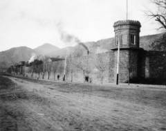
Museum of Colorado Prisons
38.439430, -105.247290
Located on the western end of Canon City this unique museum welcomes visitors to explore the history of Colorado Corrections. Individual MP3 audio tours guide visitors through 32 cells filled with exciting exhibits and life sized models that link the past to the present in dramatic presentation.
Other artifacts and exhibits include: The hangman's noose used for the last execution by hanging in Colorado. Confiscated inmate weapons and contraband. The last gas chamber. Rare, historic photographs depicting life in prison facilities. Displays of disciplinary paraphernalia used from 1871 to the present. Inmate Arts and Crafts. Gift Shop and much
Shelf Road - 22
Territorial Prison
38.436609, -105.248854
Originally built in 1871, 5 years before Colorado reached official statehood, the prison became the first in the territory. After reaching statehood, Territorial Prison became the first official state prison and housed Colorado death row inmates for a long time.
A Look at Territorial Prison
Shelf Road - 23
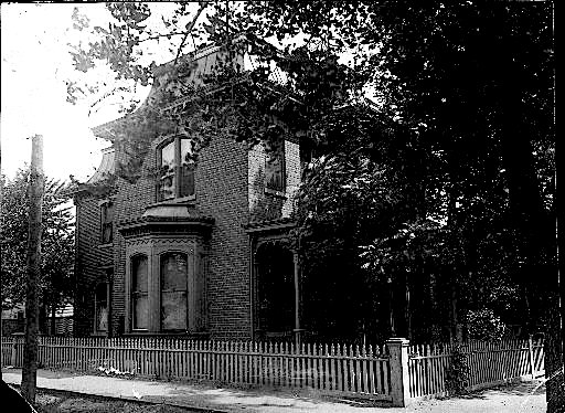
Peabody Mansion
38.438716, -105.244627
Built in the 1880s for James Clelland a local business man heavily involved in real estate, merchandising and grocery. The Peabody Mansion was used as a focal point of meetings with governors, financial managers, politicians and business leaders. It was named after future Colorado Governor James H. Peabody who originally worked for Clelland as a bookkeeper.
A Look at Peabody Mansion
High Park Road - 01
High Park Road
38.585707, -105.417997
High Park Road and Colorado Highway 9 were originally trails that connected the ranches and farms of the mountain parklands west of Cripple Creek to Cañon City. The Currant Creek Trail followed the route of present day Colorado Highway 9. Well-traveled by American Indians moving between the Arkansas River and South Park, this trail became an important route for the mountain men, explorers and eventually, people and freight headed for the mining camps of Leadville and South Park.
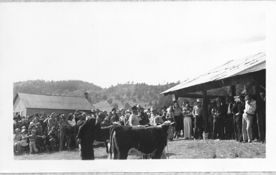
To settlers, the grassy meadows of High Park seemed ideal for raising cattle and horses; however, ranching and farming proved challenging occupations here. Settlers endured summer drought, harsh winters, unpredictable markets, rustlers and isolation. With the gold boom in Cripple Creek, ranchers and farmers enjoyed a convenient market for their products.
In 1897, the Fremont County Cattlegrowers Protective Association formed allowing ranchers to work together on common problems and to share information on important issues. Today a few of the original ranches remain, a testimony to the tenacity of early settlers.
A Look at High Park Road
High Park Road - 02
Deer Haven Ranch
38.623382, -105.380024
The five thousand acre Deer Haven Ranch includes lands that were once a part of the Switzer Ranch. Homesteaded in the early 1870s, this was one of the first cattle ranches in Fremont County. It remained a private ranch until 1992 when the Richard King Mellon Foundation and the Conservation Fund donated Deer Haven Ranch to the Bureau of Land Management to protect and enhance its rich wildlife habitat.
Historic structures on the ranch include the one-room Wilson Creek Schoolhouse and several buildings and foundations associated with ranching operations.
A Look at Deer Haven Ranch
High Park Road - 03
Bare Hills City
38.64845, -105.3341675
In 1896, prospectors founded the Bare Hills Mining District in this area. Promoters selling lots declared Bare Hills City "the future great town" of the area because it was "surrounded by veins... assaying high in gold" with "...the whole formation being the same as the gold belt of Cripple Creek." Soon, people flooded into the area, including some reputable investors.
The 1898 Colorado State Mining Directory lists fourteen mining companies in the Bare Hills District. The initial optimism died as the promoters' claims proved to be more dream than reality. Within a few years, only a few families remained. The area is part of a cattle ranch and private property.
High Park Road - 04
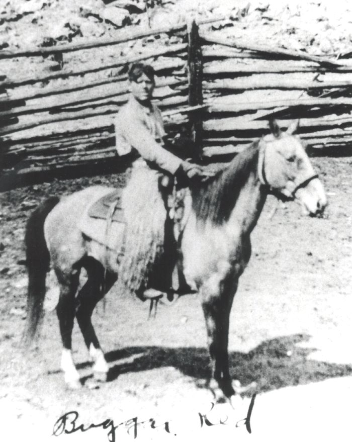
Booger Red Hill
38.713815, -105.260780
A young cowboy arrived in the Fourmile area of Teller County in 1915. Booger Red he was called because of his thick red hair and his ornery nature towards others. He worked many of the ranches in the area and met a ranchers daughter named Ruth Hall. In the fall of 1918 Red contracted Spanish Influenza and died around the age of 22. Ruth suggested he be buried near Texas Hill.
A Look at Booger Red Hill
High Park Road - 05
Four Mile Hall
38.767294, -105.286306
This building has been a focal point for local agricultural programs and social events since its construction in 1911 by members of the surrounding community. It was built of lumber milled at a saw mill just down the road, and was first called the High Park Dance Hall, as it was built to host bi-monthly dances.
In 1926, the Four Mile Farmers Club organized the first Four Mile Fair here. Known to many in the region as "The Best Little Fair in Colorado," the Four Mile Fair consistently drew large crowds to enjoy the many exhibits until it ended during World War II. Today, this building hosts dances, meetings and a variety of other events for area residents.
A Look at Four Mile Hall
High Park Road - 06
Conservation Efforts of Area
38.821831, -105.259650
Palmer Land Trust has conserved over 3500 acres along the Gold Belt Scenic Byway, one of the country's premier scenic byways. It contains an impressive topography and a variety of ecosystem types that span areas ranging from 6,900 feet to 10,000 feet in elevation, with views of the back side of Pikes Peak, "America's Mountain," world-class rock climbing, and the valley floor of Fourmile Creek.
A variety of habitat types, including riparian shrubland and irrigated pasture habitat as well as ponderosa, pinion pine woodland, and montane grasslands, provide habitat to bighorn sheep, wild turkey, black bear, mule deer, and mountain lion. Historically, the area has been used for ranching and some still remain productive today for rotational grazing and irrigated hay meadows.
Recreationists also flock to the area to take advantage of the scenic open space for hiking, biking, and fishing. The conservation efforts along the byway address all these attractions: Colorado's farming and ranching heritage, open spaces and scenic vistas, public access to recreational opportunities, and wildlife habitat.
A Look at Conservation Efforts of Area
Teller County Road One - 01
Teller County Road One
38.747331, -105.188680
County Road One traverses a picturesque mountain valley. It retraces the trail followed by stagecoaches and wagons traveling between the Colorado Midland Railroad depot at Florissant and the Cripple Creek Mining District. This dirt trail was one of the most direct routes to the mining district from Colorado Springs.
During the early years of the gold boom, freight wagons loaded with equipment, supplies and gold ore as well as stagecoaches of fortune seekers traversed the road daily. This important stop on the way to Cripple Creek holds a unique treasure one to rival Cripple Creek's gold.
Incredibly plant and animal fossils from 34 million years ago lie in rich fossil deposits near the town of Florissant. Today, these fossil riches are protected within Florissant Fossil Beds National Monument.
A Look at Teller County Road One
Teller County Road One - 02
Florrisant
38.946154, -105.289355
The town of Florissant grew up along the Ute Pass Wagon Road in the early 1870s when Judge James Castello established a small ranch and trading post on the banks of Twin Creek. Castello names his new home Florissant, 'flowering' in French. Ute Indians, a tribe with a long history in the area, visited the Castello home frequently and befriended the family. Chief Colorow presented Mrs. Catherine Castello with a buffalo robe that now resides in the Colorado Springs Museum.
In 1896,the Colorado Midland Railroad reached Florissant. When the Cripple Creek gold boom began around 1892, Florissant became a bustling jumping-off point for people and freight bound for the mining district. The road between Florissant and Cripple Creek carried heavier freight traffic than the shorter route between Divide and Cripple Creek because of its easier grades.
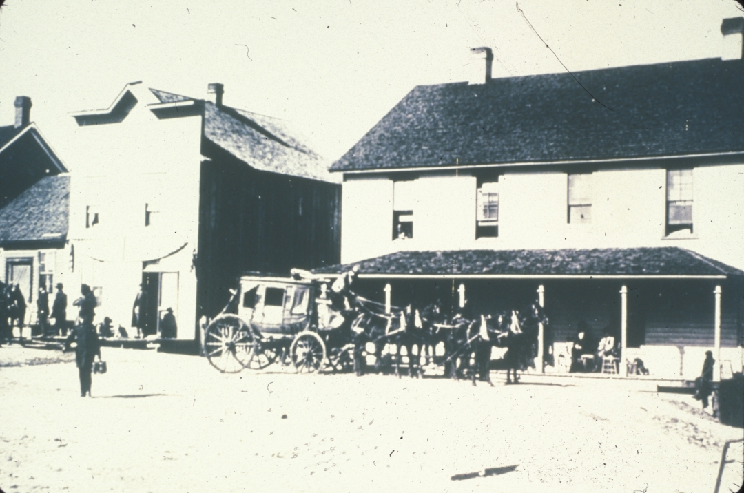
Tons of equipment and supplies traveled by freight wagon, wagons carrying gold ore transferred their freight to the Midland Railroad at Florissant for processing at mills as far away as Aspen. The Hundley State Line, the first stagecoach into Cripple Creek, operated 15 six-horse stages daily carrying passengers and mail to the mining district.
Today, visitors to this tiny hamlet can see the original Florissant School, now the Florissant Grange. The school board purchased the land from the Castello family in 1887 and the school is opened in the fall of the same year. In 1960,the Florissant Grange purchased the school continuing its history as an important focal point for the community. The original teacher's residence was also returned to the site in ---- and serves as a museum.
A Look at Florrisant
Teller County Road One - 03
Florrisant Fossil Beds National Monument
38.913639, -105.280669
This beautiful mountain valley just west of Pikes Peak holds spectacular remnants of the earth's pre-historic life. About 34 million years ago, violent volcanic eruptions in surrounding areas caused large mudflows. These mudflows buried trees in the low-lying areas of the valley to a depth of about fifteen feet. Over time, many trees petrified - turned to stone. A later mudflow created a dam at the south end of the valley and a lake, ancient Lake Florissant, filled the valley.
The lake sediments became the final resting place for thousands of insects and plants. Over time, these sediments turned to shale, preserving the delicate details of organisms as fossils.
In 1874,A.C. Peale of the Hayden Survey published a report detailing the amazing variety of fossils in the area. Since then, paleontologists have collected about 50,000 specimens for museum and universities around the world. These fossils reveal, in remarkable detail, what life of so long ago was like. In 1969, this area was set aside as part of our National Park System.
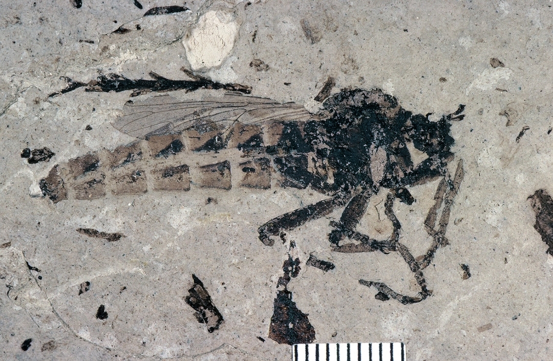
Florissant Fossil Beds National Monument is home to one of the richest fossil deposits in the world. Over 1,700 fossils of insects, plants, birds, fish, mammals and other organisms have been discovered, described and protected here. Nearly 1,500 of these fossils are insects, which are rarely preserved in the fossil record. Massive petrified redwoods, are easily seen behind the visitor center and on the 1mile Petrified Forest Trail.
The park is a 6,000 acre wonderland of pine forests, mountain meadows, beautiful scenery and wildlife. There are 14 miles of easy to moderate hiking trails to explore, self-guided and ranger guided programs, a Junior Ranger program and a state-of-the-art visitor center with exhibits, film, and a bookstore. This national park area is an active study site where an ongoing paleontology program conducts research. Discoveries are still being made!
A Look at Florrisant Fossil Beds National Monument
Teller County Road One - 04
Hornbek Homestead
38.926989, -105.281680
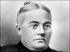
Adeline Hornbek, a single mother of four children, defied nineteenth century traditions to become the owner of a prosperous ranch in the Florissant Valley. In the spring of 1878, Adeline Hornbek filed a claim under The Homestead Act of 1862 to 160 acres of land about two miles south of Florissant.
Her homestead house is not the typical one-room cabin that we envision when thinking of frontier life. Instead, it is a one and one half-story, four bedroom log house with nearly a dozen glass-paned windows. It was the first two story house in the valley. Ornate Victorian-style furnishings graced the interior. Several outbuildings including a milk house, chicken house and stables completed the homestead.
(Note the outbuildings on the site were relocated from other homesteads in the area to represent the original outbuildings on the Hornbek Homestead. But yes the house is the original).
Mrs. Hornbek supported her family by raising and selling horses and working in town at the Florissant Mercantile (the general store). She became a prominent member of the growing community of Florissant, serving on the school board and hosting social gatherings in her home. By the time she filed the final papers on her homestead in 1885, the value of her property had increased nearly five times.
A Look at Hornbek Homestead
Teller County Road One - 05
Overall Fourmile Area History
38.9424729, -105.2891143
The area around Pikes Peak was the traditional territory of the Tabeguache Ute Indians. The Tabeguache, or "People of Sun Mountain," was the largest of the ten nomadic bands of the Ute. They followed the herds of wild animals throughout their lands, hunting elk, deer and buffalo at specific places at certain times of the year. They moved their camps every three to four weeks to access fresh hunting grounds. As late as the 1870s Ute encampments in the valley south of Florissant numbering 500 tepees were recorded.
In 1870 Judge James Costello established a trading post at Twin Springs, now Florissant, to trade with the Utes as they roamed the area. Two years later, he requested that a US Post Office be located there and it was named Florissant after his hometown, Florissant, Missouri. This trading post led to the gradual settlement of the valley south of Florissant along the present Teller County Rd. 1. Settlers practiced farming and ranching. Potato farming was especially successful and continued until the 1930s when the local climate became dryer and the water table in the area dropped , making commercial farming impossible.
The Colorado Midland Railroad arrived in 1887 and Florissant became the destination for "Wildflower Excursions" from Colorado Springs. Initially farmers and ranchers shipped their produce from Florissant, but after gold was discovered in Cripple Creek in 1890 agricultural produce was shipped to the mining district to feed the miners and their families.
During the gold rush, the route from Florissant to Cripple Creek, now Teller County Rd. 1, was heavily travelled. The Hundly Company established a stage line and eight coaches a day made the 20 mile trip from Florissant to Cripple Creek. Before the railroad reached Cripple Creek, gold wagons from Cripple Creek overnighted at the large Welty barn near the present Evergreen Station, halfway to the rail line in Florissant.
Potato farming is no longer possible in the valley, but many family ranches remain, some owned by the same families that established them in the late 1800s and early 1900s. Several of these ranches have been placed under conservation easements by their owners, so that they will remain available for ranching or preserved as open space into the future.
A Look at Overall Fourmile Area History
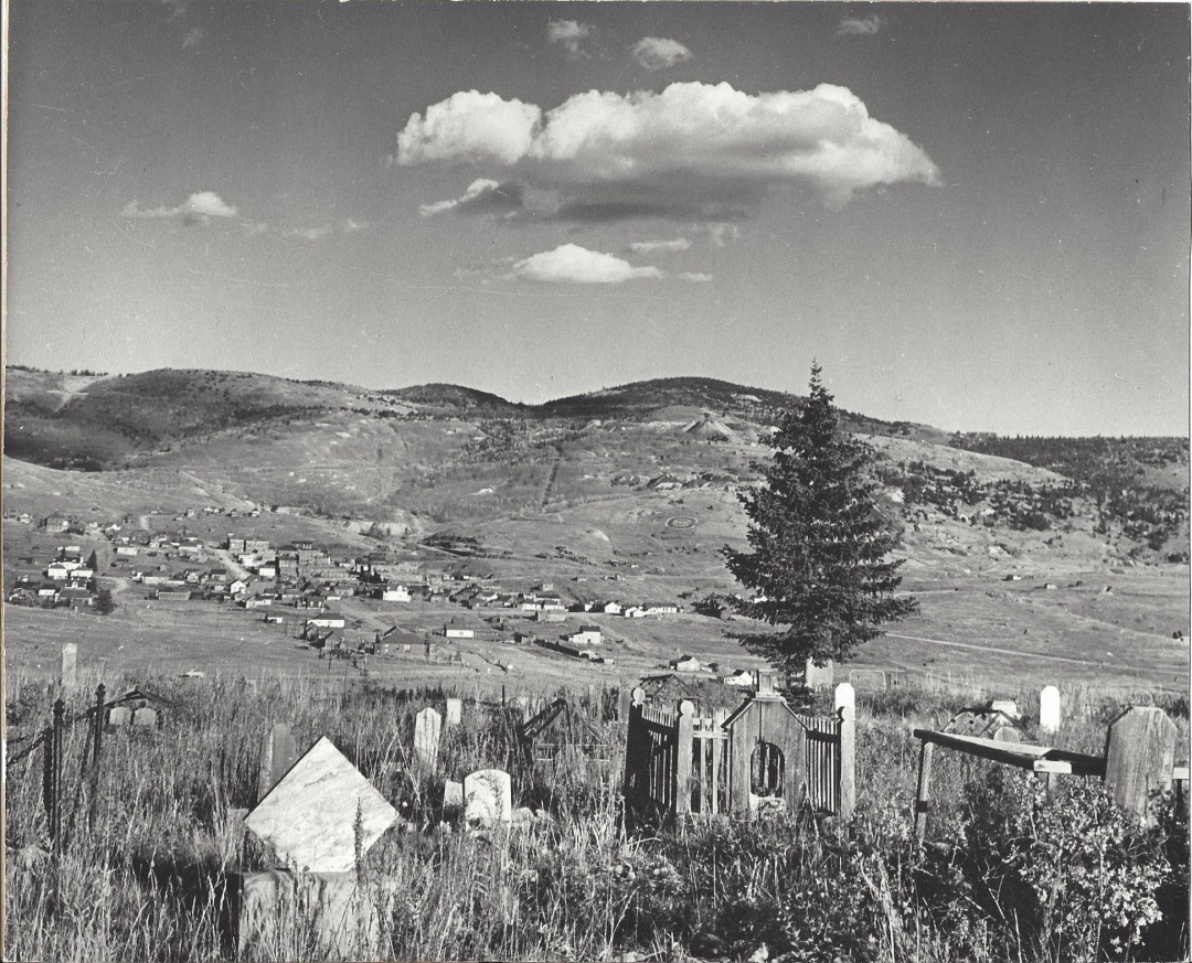
Teller County Road One - 07
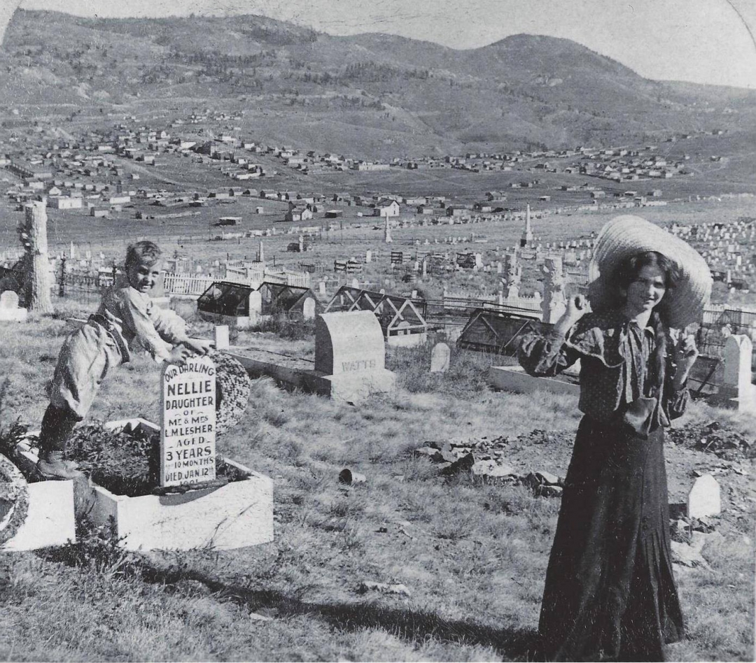
Mount Pisgah Cementery
38.750050, -105.191606
In 1892, the gravelly eastern slope of Mount Pisgah held little promise for miners, merchants and homesteaders but today it is one of Cripple Creek's oldest and richest historic sites. This 40 acre cemetery includes plots for the Improved Order of Redmen, Woodmen of the World, and
Grand Army of the Republic. Many people and their families, and several individuals of "local fame and infamy" were laid to rest on this peaceful mountainside. The cemetery remains a natural site with many species of native plants and colorful wildflowers in summer. Visitors are welcome, and reminded to respect the sacred nature of the site.
A Look at Mount Pisgah Cementery
Teller County Road One - 08
Cripple Creek
38.750115, -105.191221
Cripple Creek began as two tiny hamlets called Fremont (est. 1891) and Hayden Placer (est. 1892). Nearby lay Poverty Gulch, the site of several promising gold discoveries. Tents, cabins, and flimsy wooden shelters housed hundreds of miners as the boom began. Within a few years, the two towns merged to provide better services to the thousands of people living there.
By 1900, Cripple Creek thrived as the marketing and financial center for incredible wealth flowing from the mines. The business of this era included three stock exchanges, three banks, fifty two stockbrokers, and ten insurance agents. A thoroughly modern city, Cripple Creek offered residents electricity, telegraph and telephone systems, two opera houses, eight newspapers, and transportation around the district via electric streetcars.
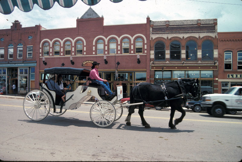
Today, the entire commercial and residential area of Cripple Creek is a National and mark and limited stakes gaming has revitalized Cripple Creek's economy with casinos, shops and restaurants. A self-guided walking tour of the historic downtown begins at the Cripple Creek District Museum. In the summer, the historic Butte Opera House offers a traditional melodrama, music and other fun.
A Look at Cripple Creek
Teller County Road One - 09
Cripple Creek District Museum
38.747079, -105.172354
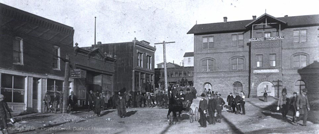
Founded in 1953 by Blevins Davis and Richard Wayne Johnson, the Museum has 3 main buildings: The 1894 Colorado Trading & Transfer Company building,the 1895 Midland Terminal Depot that was used as a depot until 1949; and a miner's cabin circa 1890-1930. The museum is open year round and every day from Mid-May to Mid-October 10 a.m. To 5 p.m.
The last tour begins at 4:30 p.m. Located on Bennett Avenue, the museum complex contains the main buildings with six floors of mining memorabilia, maps, paintings, glass and china, children's items, furnishings, an assay office, a photograph gallery, Indian artifacts, mineral displays and two Victorian apartments.
A Look at Cripple Creek District Museum
Teller County Road One - 10
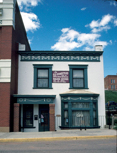
Old Homestead House Museum
38.745992, -105.175050
The Old Homestead House, last of the infamous Pleasure Palaces of Cripple Creek, stands today in quiet dignity on Myers Avenue in mute testimony to its raucous, glamorous past. Bright lights, the tinkling of pianos, the course shouts of the pleasure-seeking miners are gone but the Old Homestead remains.
The sturdy old building was erected in 1896 following the great fire and under the direction of such experts as Pearl Devere, Hazel Vernon, Neil McClusky, Laura Evans and Lola Livingston. It achieved fame as has been accorded only to such noted European Brothels as the Trois Moulins in Paris.
At the height of its fabulous career it enjoyed the finest trade, gave the grandest soirees and, in general achieved the greatest sophistication of any brothel in the Gold Camp. The Homestead's girls, in their Parisian gowns and leghorn hats, were the scorched toast of the town and the only thing they had in common with their sisters of the cribs was their profession.
At the peak of its Gold Rush period Cripple Creek had five city blocks of Red Light District, with apx. 350 girls working. The Old Homestead House was the most expensive house of pleasure, with prices starting at $50.00, only open to the most riches of men. 27 men made their millions in the district, so there was plenty of money around to spend on this guilty pleasure house.
Today only the Old Homestead House stands in testament to the heady past of Cripple Creek. 10 rooms are available on the half hour tour, running from Memorial Day thru September, 7 days a week 11am to 5 pm. Your visit to Cripple Creek, the world's greatest Gold Camp, will not be complete until you seen the treasures of the Old Homestead.
A Look at Old Homestead House Museum
Teller County Road One - 11
The Outlaw and Lawmen Museum
38.746340, -105.182039
The Outlaw and Lawmen Museum is located in Cripple Creek. Call for open hours: (719) 689-6556.
The museum once served as the Teller County Jail. This two story building located on the corner of Bennett Avenue and A Street, was opened for business in July of 1901. At that time, Cripple Creek was a booming gold mining town, full of characters from every walk of life, looking to find their fortune. For some, their dreams of gold never came to fruition, leaving many to turn to a life of crime.
The Cripple Creek Jail Museum houses 17 original cells and it served as the Teller County Jail from 1901 until its closure in 1992. 14 of those cells were reserved for men, 3 cells for females, and one holding room for juvenile delinquents . The criminals residing in this "bastille" ranged from drunk and disorderly, to murder. The Teller County Jail was the last stop before being sent to the state penitentiary in Canon City. The building was designed to hold 100 criminals, and yes, it was filled to capacity on more than one occasion.
Today, you can visit the Cripple Creek Jail Museum for a hands-on experience. There are artifacts to view, as well as, local history and even some inmate history to read about. The cells are open for you to explore, striped jail suits are available for you to put on and you can take your own mug shot for a photo memory to take home.
Pictures are welcome throughout the facility, and don't be surprised if you capture a "resident" from the past! Yes, the Cripple Creek Jail Museum is known for paranormal activity and was featured on Travel Channel's "Ghost Adventures" in August of 2010. Stop in at the Cripple Creek Jail Museum and find out who is still locked down!
Need Help With Ideas For Your Itinerary Of Your Tour?
We Can Help! Contact Gold Belt Tour Scenic and Historic Byway